One Point Five Years Ago
Early last year, I was playing around with a simple terrain engine. It was your basic height-field based terrain engine. It was also crap-tastic. But hey, you’ve gotta start somewhere. Thus, I started with this:
(Click To Enlarge)
Kinda lame, but it was a good test. Each chunk was LODified by using a Binary Triangle Tree, which was a great simplification method, though I did eventually switch to using progressive meshing (though leaving the edges in-tact…not the greatest LOD scheme ever). It was then that I had a vision. Well, not so much a vision, but an idea. Well, not even an idea. More of a thought. Cliffs! That’s right, cliffs. And caves. Those were two things that I would love to have, but they’re impossible with a straight-up heightfield renderer. So I set my tired code aside, and began my next crazy scheme.
Terrain Idea The Second!
So, I thought: what if I could model a level in a manner similar to making a topographical map. Something like this:
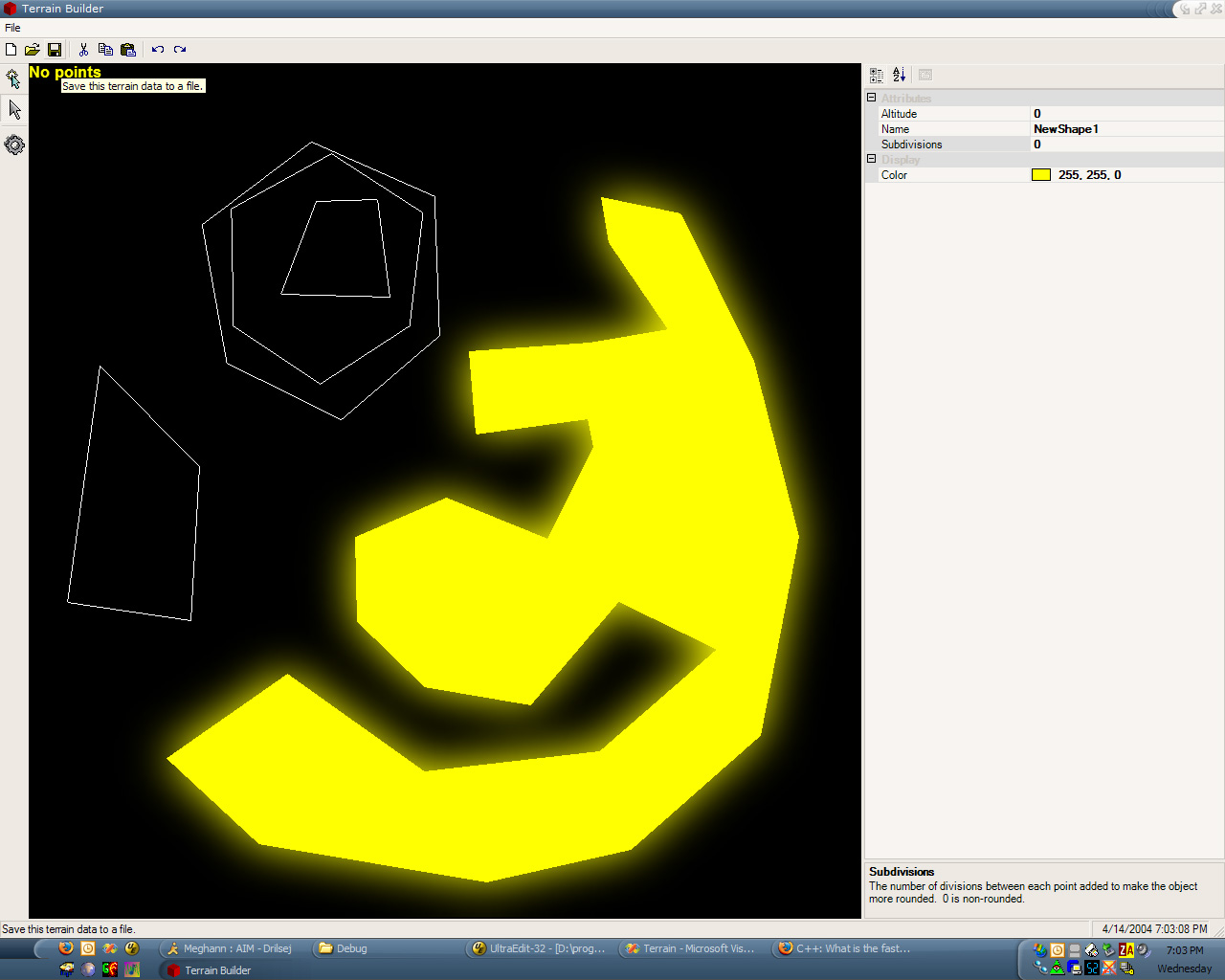
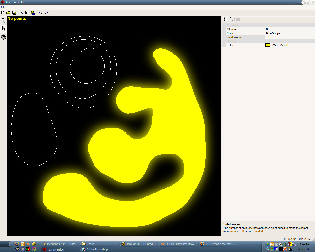
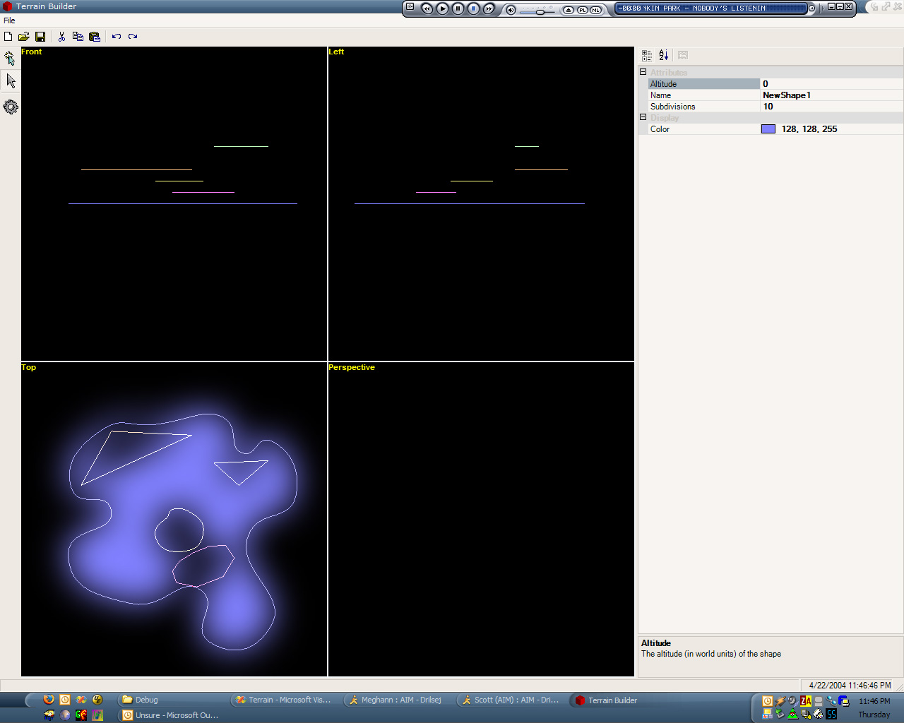
(Click To Enlarge)
In this system, each shape could be drawn, and given a height value. The editor would fill in the drawn shapes with polygons, connecting them to the other inner shapes (and outer shapes), adding slopes when asked (or making a given shape a plateau).
Sound crazy? It was. I coded it for about three months, working on logic to triangulate a complex polygon (overlapping not allowed) which contains children (which are holes in the parent polygon). Then I worked on smoothing the polygons by adding curves (see the first two screenshots for a comparison). Each edge was essentially a bezier curve, where the middle two control points were placed based on the angle of the connection to the next/previous line segments.
Now, right about now, you may be thinking to yourself: “How does this solve the problem of caves? How did you handle the LOD switching? Isn’t this a lot of work? What’s the meaning of life?” To answer your questions, in order: It doesn’t, I didn’t, Way too much, and free beer. This particular concoction was way too complex, and not near enough to what I wanted. So it, too, was scrapped.
The Not So Distant Past, Or: How to Totally Copy SSX’s Idea
I started browsing the web for other creative ways to generate terrain. It was then that I came upon THIS article. What a brilliant idea, I thought! Use curved surfaces to model terrain! So I started work on Terrain III: Terrain With a Vengeance. Not too long afterwards, I had a decent curved-surface terrain. The beziers were calculated in a vertex shader, given the matrix representation of the surface as a 4×4 matrix. Each vertex buffer simply contained the u and v coordinates (in the range [0, 1]) for the patch of the given resolution (different vertices in the vertex buffer were used for different tesselations). However, there were two big problems:
- The vertex shader was somewhat slow, with the extra matrix multiplications (three 4×4 multiplications and a dot product for position alone)
- There were cracks between the patches, due to floating-point rounding errors.
So, I thought, what if I calculated the patches in software in a big dynamic vertex buffer, using a better method? I ended up using de Casteljau’s Method on the edges of the patches, because it does not have the same floating-point issues that the matrix representation does. However, I continued using the matrix method on the interior points, for speed reasons. Each patch was cached into the vertex buffer using a cheap LRU cache. This eliminated the “sparkles” caused by the floating-point errors, and significantly improved my framerate. And now, screenshots:


(Click To Enlarge)
This method worked well, but there were issues with locking/unlocking the buffer. Also, 800 patches meant 800 DrawPrimitive calls, which is, how you say, lame. Thus, I rebuilt the cache algorithm (Yes, I have the technology) to cache items into a set of smaller vertex buffers (that I called “slices”), which were each bound to a specific material (i.e. grass, etc). Thus, they could be batched up better. Soon, 800 patches meant only about 30 draw primitive calls. Which was way better, but there was still a problem. With great caching comes great framerate instability. Since the caching algorithm would sometimes not have to do anything, but sometimes it would have to cache a lot of patches, the framerate became very unstable. Even though it was running faster than 100 fps almost the entire time, it was still highly visible stuttering (especially when I fillrate-limited it a bit). Plus, there became the question of how to actually MODEL such a terrain (I was going to have to write a super-complicated terrain editor). So I wavered. It seemed that there were many, many problems with this implementation and that, while it’s definitely cool, I don’t know that I’m going to be able to do what I want within my newly-created timeframe. So I decided to set this method aside as well, and move on.
The Present, But Not the Birthday Kind
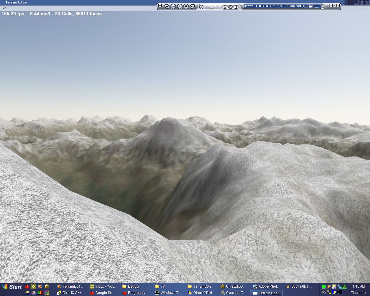
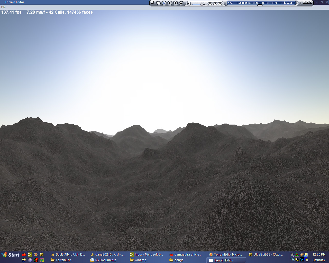
And that brings us to now. I’ve decided that I’m going to use a simple mesh format for the terrain, though with LOD data built into it. That way, I can use an existing modeling program (I’m looking at you, Blender) to do the modeling, build some simple texture/material/atmosphere editing utilities (or one texture/material/atmosphere editing utility), and just use that. Break it up into LOD-able chunks, and I think I have a winner!
Also, I’ll probably keep the track editing interface that I already have (though I’ll have to improve on it, obviously, since it’s…clunky, at best). But it provided me with these:
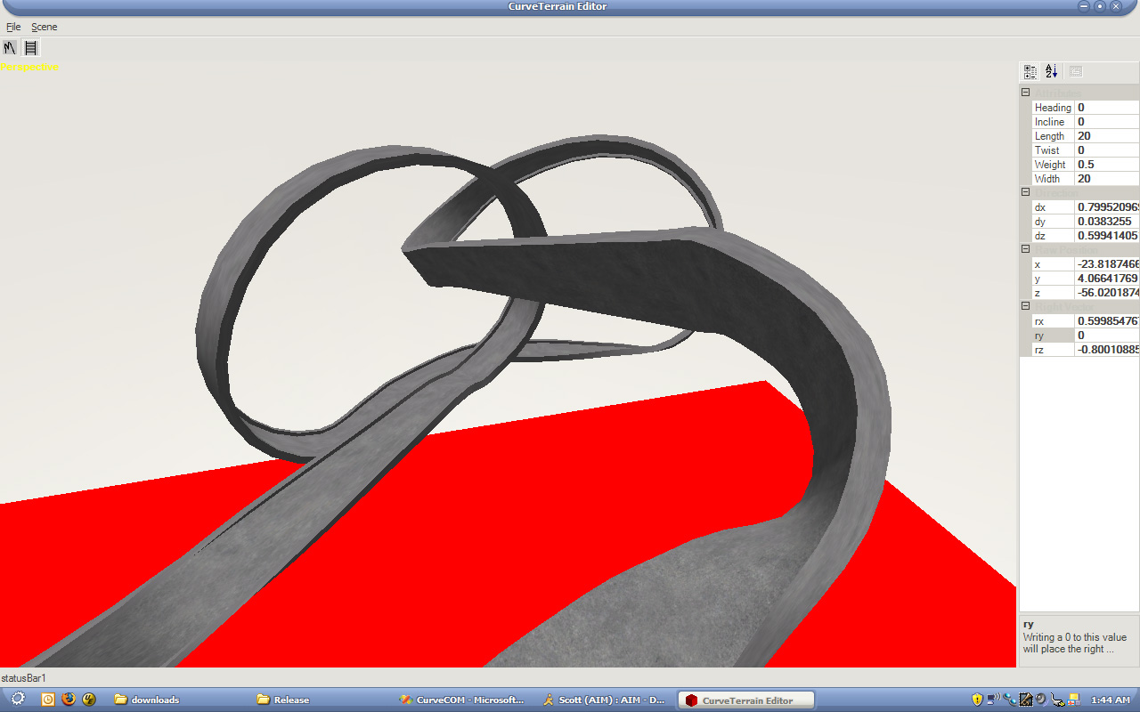
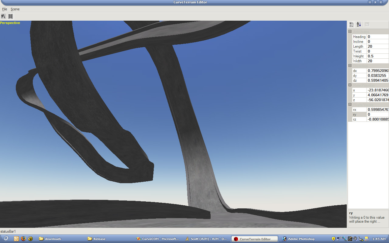
(Click To Enlarge)
Which are fairly representative of the types of tracks I’m aiming to have.
Alright, class, that’s the end of your history lesson for today. Up next: New developments in code!